About Contoocook Village Weather
Contoocook Village Weather is a non-governmental amateur weather observer website, and is not affiliated with the the village of Contoocook, its containing town of Hopkinton, NH nor any other government agency. Contoocook Village Weather uses data from its own weather instruments, as well as data shared by the National Weather Service and other organizations as allowed and licensed by them. Please contact us immediately if you believe this site is infringing on others' rights or data. Note that we provide no warranty that this service is accurate nor up-to-date and you should avoid making any serious decisions based on any data you read on the Internet.
About This Station
The station is powered by an EcoWitt weather station. The data is collected every 10 seconds and this site is updated every 20 seconds. This site and its data is collected using WEEWX software (see Station Graphs). The station is comprised of an anemometer, UV-luminance sensor, a tipping-spoon rain gauge, a barometer, and a thermo-hydro sensor situated in optimal positions for highest accuracy possible.
About The Village of Contoocook
"I think if you hold your breath you can hear the train all the way to Contoocook. Hear it?" -- Our Town, Thornton Wilder, 1938

John Phelan,
CC BY-SA 4.0, via Wikimedia Commons

Rcsprinter123, CC BY-SA 4.0, via Wikimedia Commons
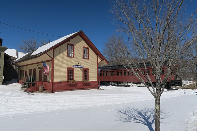
The history of Contoocook is far older than the United States. Following the retreat of the glaciers at the end of the last ice age 14,000 years ago, the area was populated by the Pennacook, Abenaki and other tribes of the Wabanaki Confederacy. Some of that history is documented by the nearby Mount Kearsarge Indian Museum and Hopkinton Historical Society. Hopkinton has preserved many historical items, including the Contoocookville Rail station, notable covered rail and road bridges.
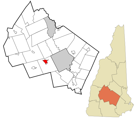
Contoocook is a village and a "census-designated place" (Wikipedia), one of several villages in the town of Hopkinton, New Hampshire, USA. Water plays an important role in Contoocook, serving utility, recreational and industrial uses. The village is bisected by a river of the same name, both most likely mistranslated from the Pennacook or Abenaki native languages. Water plays an important part in early Hopkinton history: the Contoocook River was the main highway for native populations, flowing from Peterborough to merge in town with the Warner River and the Blackwater River. The Contoocook flows on, merging in Boscawen with the Merrimack River, connecting river traffic to the north and, to the south the Merrimack empties into the Atlantic Ocean. Spring flooding lead to the construction of the Hopkinton-Everett Flood Control project, a huge undertaking which flooded West Hopkinton Village and includes towns of Weare and Dunbarton, with a capacity to hold back an astounding 54 billion gallons of floodwaters.
Ponds include Rolfe Pond, Lake Josylvia, Grassy Pond, Kimball Pond and Kimball Lake, great places for recreation and swimming in the summer.
About This Website
This site is run by Ted Roche and you can email him at "webmaster" AT "iayft" "DOT" "COM". The site was run from 2010 to 2023 by the late Keith Wallace, who inspired me to set up and run my own weather station.
This site is a template design by CarterLake.org with PHP conversion by Saratoga-Weather.org.
Many thanks to the many developers who have writen an add-on or added pages reflecting their particular interests: Rounded Corners, River Levels, etc. Many hands make light work.
Special thanks go to Kevin Reed at TNET Weather (via archive.org) for his work on the original Carterlake templates, and his design for the common website PHP management.Special thanks to Mike Challis of Long Beach WA (via archive.org) for his wind-rose generator, Theme Switcher and CSS styling help with these templates.
Special thanks go to Ken True of Saratoga-Weather.org for the AJAX conditions display, dashboard and integration of the TNET Weather common PHP site design for this site.
Template is originally based on Designs by Haran.
This template is XHTML 1.0 compliant. Validate the XHTML and CSS of this page.

