


Weather Forecast Offices Story Page Viewer
| WEATHER STORY Houston/Galveston Weather Forecast Office |
|
|||||||
|
|||||||
|
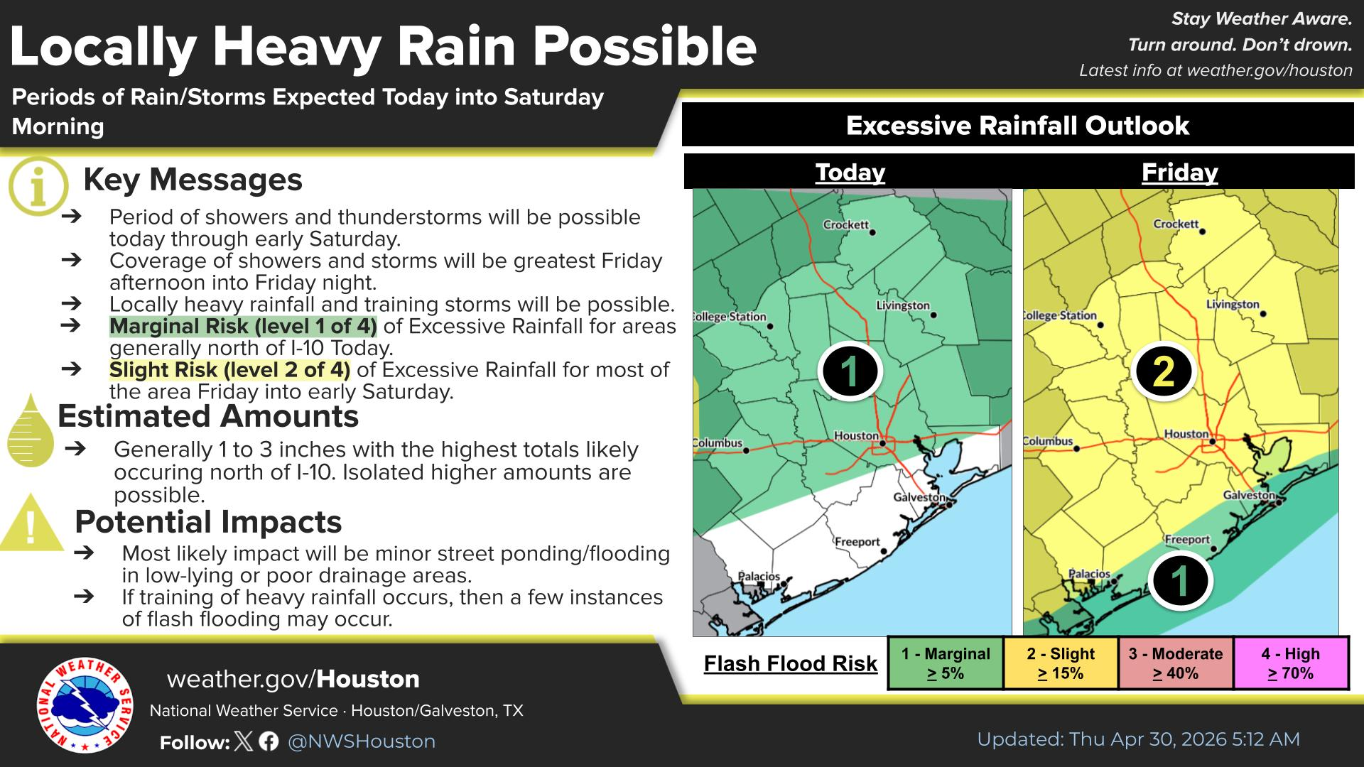
Periods of showers and thunderstorms are expected today through early Saturday, with the greatest coverage Friday afternoon into Friday night. Locally heavy rainfall and training storms are possible. A Marginal Risk (level 1 of 4) for Excessive Rainfall is present today north of I-10, increasing to a Slight Risk (level 2 of 4) Friday into early Saturday for most of the area. Total estimated amounts are generally 1 to 3 inches, primarily north of I-10. Minor street flooding is the most likely impact, but a few instances of flash flooding are possible if training heavy rainfall occurs.
|
Select a Different Office Below

Data Courtesy of Houston/Galveston Weather Forecast Office